Gateway Airport Fixes Freeway Signage Problems
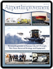
 Passengers have been flocking to Phoenix-Mesa Gateway Airport (AZA) in droves for the past few years. But until recently, many had trouble finding it. With just one sign on the freeway, guests would often exit prematurely or miss the airport exit altogether. GPS units weren't much help either, as mapping agencies have had difficulty keeping current with rapid development in the area.
 factsfigures factsfigures
Project: Freeway Signage Update Location: Phoenix-Mesa Gateway Airport Prime Consultant: Otak Engineer: Jacobs Engineering |
A new series of signs, however, gives airport visitors more warnings about impending exits, and points them to the easiest and most direct path to the airport. And best of all, the wayfinding improvements cost the airport a fraction of what officials initially expected.
According to a preliminary report from Airports Council International, AZA is the fastest-growing airport in the country, with double-digit growth for the last several years. In 2012, AZA served nearly 1.4 million airline passengers - an astounding 45% increase vs. the previous year - and added two gates and a post-security courtyard. The rapid growth, however, exacerbated AZA's existing off-airport wayfinding problems. With complaints about difficulty locating the facility bubbling to the surface of annual passenger surveys, airport officials took action.
Part of the issue was the airport's name. Over the past 20 years, it has changed from Williams Air Force Base to Williams Gateway Airport to Phoenix-Mesa Gateway Airport, as it's called today. As such, some drivers who couldn't find the proper airport signs often mistakenly took the exit for Williams Field Road, which is five miles from AZA via surface roads.
"When we changed the name to Phoenix-Mesa Gateway Airport, local people still called it Williams Gateway. And until about two years ago, signs for 'Williams Field' still existed," explains Brian Sexton, the airport's public information officer.
Dovetailing Plans
The airport hired Otak to develop a master plan for new signage and wayfinding. Ongoing efforts led by Senior Planner Brad Bielenberg began in December 2012, with Otak personnel collecting background information and taking inventory of all existing signage. Concurrently, they conducted a precedent study, evaluating how 15 airports around the nation approach freeway and arterial road signage, and analyzed a user study of passengers traveling to and from AZA.
During the preliminary work, personnel discovered that the Arizona Department of Transportation (ADOT) was already planning to update signage on state route 202 during construction of a new freeway leading to the airport. When ADOT and the airport met to discuss the project, they determined which signs could be modified to improve airport wayfinding.
"Because of the timing of ADOT's construction project, we were able to include better airport signage into their sign package," explains Casey Denny, deputy director at AZA. "We did it by simplifying messages and increasing the number of signs, which ADOT funded as part of their freeway construction project."
A series of 13 new signs now direct visitors to the airport. Nine were already in ADOT's plan but were modified, per suggestions from AZA and its consultants. The state agency also agreed to add four more signs to facilitate overall traffic flow and improve airport wayfinding. Because the requests came before any signs were fabricated, cost increases were minor, and ADOT was open to the changes, recalls Denny.
"Because the plan was already in place, the airport was not required to fund the signs, saving us a great deal of money," he adds.
Simplifying the signs was a key change, notes Bielenberg. The new signs include the airport symbol (an aircraft silhouette) and a single word - Gateway - rather than AZA's full name, Phoenix-Mesa Gateway Airport. This was the best way to incorporate the signage that was already scheduled without making major design changes, he notes.
Bielenberg and the Otak team, which includes Selbert Perkins Design, Jacobs Engineering and Gunn Communications, then worked with ADOT to develop the signs to ADOT specifications.
"When the airport's staff approached us, it made sense to include their plan for improved signs while we were still working on our freeway project," says ADOT spokesman Doug Nintzel. "Our agency works hard on partnerships with local communities and agencies. We certainly were open to working on something that will help freeway drivers as they approach Gateway Airport."
Assembling the Pieces
AZA is owned and operated by the Phoenix-Mesa Gateway Airport Authority, which encompasses four different communities in addition to the cities of Phoenix and Mesa. The airport took care to keep each one posted on the new highway signage, working particularly close with the city of Mesa as the project developed with ADOT.
"The freeway runs through the city of Mesa," Denny explains. "When a passenger takes the freeway exit to the airport, they pass through the city. With that in mind, we wanted to ensure that they were happy with the way the signs were installed.
"They were very helpful and instrumental toward completing this project in a timely manner; the cooperation they exhibited is what allowed the timeline to progress so quickly. Everyone was aligned. Gateway is a regional destination, and everyone supported the new freeway signage. "
With fully 60% of AZA passengers arriving from out-of-state, clear and highly visible freeway signs are paramount to the trajectory of the airport's growth.
"Many people don't know there are two airports in the Phoenix area," explains Sexton. "This is going to help tremendously."
ADOT is equally excited. "Over time, we've heard from drivers who have wondered if we were going to do anything about the signs along Loop 202," says Nintzel. "We assured them that their patience would be rewarded with the freeway improvements and new, improved signs."
Denny, who has worked with AZA for 20 years, predicts that recent wayfinding improvements outside the airport will pay dividends immediately and, more importantly, in the coming decades as economic development in the area continues to take shape.
"Going forward, we would like to extend the signs into the metro area for an even further reach," he notes.
Currently, AZA serves more than 35 cities with non-stop service via Allegiant and Spirit Airlines, and provides continuing service to many more destinations. Although the airport's recently updated master plan is based on enplanements reaching 850,000 by 2017, AZA is on pace to exceed that forecast by the end of 2015.
With better signs now in place, the drive to the airport will surely be faster and easier for passengers. And that, in turn, should help AZA manage its rapid growth.
FREE Whitepaper
PAVIX: Proven Winner for All Airport Concrete Infrastructure

International Chem-Crete Corporation (ICC) manufactures and sells PAVIX, a unique line of crystalline waterproofing products that penetrate into the surface of cured concrete to fill and seal pores and capillary voids, creating a long lasting protective zone within the concrete substrate.
Once concrete is treated, water is prevented from penetrating through this protective zone and causing associated damage, such as freeze-thaw cracking, reinforcing steel corrosion, chloride ion penetration, and ASR related cracking.
This white paper discusses how the PAVIX CCC100 technology works and its applications.
Featured Video
Featured Video
Digital Issue:
Connect


Publisher's Blog

# # #
Industry Insider

Project Nominations
Know of a project that should be covered in a future issue of Airport Improvement?
Artscapes
")
# # #
# # #
# # #
Airport Industry Headlines
- RAA Issues First Quarter 2024 Workforce Report
- Fresno Yosemite International Airport Announces New Food Truck Program With a Local Twist
- MIA hosts rehearsal tour for future travelers with special needs
- HDOT LAUNCHES AUTONOMOUS ELECTRIC SHUTTLE AT DANIEL K. INOUYE INTERNATIONAL AIRPORT
- Ontario International Airport passenger volume higher by 11% in March and 10% through the first three months of 2024
# # #
Airside Projects
- New Apron Lighting Resolves Glaring Issues at Dallas Love Field
- Florida’s Statewide Markings Program Evolves
- Lincoln Airport Takes Creative Route to Adding New Leisure Service
- New Taxiway at Myrtle Beach Int’l Improves Airfield Safety, Frees Space for Terminal Expansion
- Tampa Int’l Plots New Course to Enhance Airfield Safety
Baggage Projects
- Rapidly Growing Volume of Oversized Baggage Prompts System Redesign at Salt Lake City Int’l
- Columbia Metropolitan Upgrades Baggage System and Ticketing Lobby
- Long Beach Airport Adds Permanent Checked Baggage Inspection System and Improves Ticketing Building
- New Concourse at Phoenix Sky Harbor Features Advanced Baggage Handling System
- New Baggage System at Orlando Int’l Features Individual Totes and Upper-Level Claim Area
# # #
Cargo Projects
- Spokane Int’l Builds Rail-Truck Facility on Surplus Land
- Halifax Stanfield Builds Cargo Park With Cold Chain Capabilities
- Extensive Cargo Growth at Cincinnati Int’l Boosts Revenues, Diversifies Business Base
- FedEx Expands at Ontario Int’l to Support Growing E-Commerce Demand
- Winnipeg Int’l Adds Multiuse Facility to Enhance Cargo Operations
Concessions/Retail Projects
# # #
Emergency Operations Projects
- Decatur Airport Builds New Facility for Firefighting and Maintenance Teams
- Naples Airport Recovers After Hurricane Ian’s Saltwater Storm Surge
- Sacramento Int’l Builds Bigger, Better Fire and Rescue Station
- Hybrid Fire Station at San José Int’l Provides Emergency Services for Airport and Surrounding Area
- New Facility at Coastal Carolina Regional Consolidates ARFF Ops, Boosts Efficiency
Environment/Sustainability Projects
- Toronto City Airport Leads the Move to Fluorine-Free Firefighting Foam
- New Noise Technology System at Minneapolis-St. Paul Int’l Earns Patent
- Martha’s Vineyard Airport Tests Underground Filtration for PFAS Contamination
- Santa Maria Airport Takes Common Sense Approach to PFAS Testing
- Philadelphia Int’l Follows Envision Program for Major Taxiway Rehab
# # #
Fuel Operations Projects
General Aviation Projects
Ground Support Projects
- Montgomery Regional Leaps Into the Future With Electric Aircraft Chargers
- Exterior Jet Bridge Coating Saves Energy, Increases Passenger Comfort at Harry Reid Int’l
- O’Hare Moves Aircraft Deicing From Gates to High-Tech Centralized Facility
- Ground Power Upgrades in the Works at Newark Int’l
- Long Beach Airport & Airline Partners Phase Out Fossil Fuels for Ground Support Equipment
# # #
Hangar Projects
IT/Communications Projects
- Website Platform Helps Airports Attract More Customers
- Virtual Ramp System at Kansas City Int’l Provides 360-Degree View of Airfield
- Interactive Web Page Offers Planning Tools for Memphis Int’l Travelers
- Seattle-Tacoma Int’l Invests in Data Management Upgrade
- Philadelphia Int’l is Updating - and Monetizing - Its Information Technology Network
Landside Development Projects
Operations Projects
- Terminal Expansion at Kansas City Int’l Prompts New Snow Removal Strategy and Equipment
- New Glycol Recycling Facility at Syracuse Hancock Int’l Produces Deicing Fluid Certified for Reuse
- Drones and Virtual Reality Speed Control Tower Siting at Boulder City Municipal
- St. Louis Int’l Looks to Future With Master Plan Projects to Consolidated Terminals
- Sweet Charity: Airports Large and Small Open Their Facilities to Support Local Fundraisers
Parking Projects
- Sarasota-Bradenton Int’l Adds New Cellphone Lot With Improved Amenities
- Flagstaff Pulliam Implements Paid Parking Program
- New 7-Level Garage Increases Parking Capacity and Convenience for Customers
- Regina Int’l Optimizes Parking with 24/7 Call Center and On-site Customer Service Reps
- Canyonlands Regional Upgrades its Parking Payment/Collections System
Passenger Transport Projects
- Plane Train Extension is on Track for 2025 Delivery at Atlanta Int’l
- “Wingless Travel” Takes Flight at Regional Airports
- Inductive Charging for Electric Shuttles
- Winnipeg Int’l Launches Self-Driving Wheelchair Service
- Long-Awaited Rail Extension Is Just the Ticket to Spur Growth at Washington Dulles
Runway/Ramp Projects
- Vancouver Int’l Turns Untimely Winter Storms Into Opportunity for Improvement
- Airports Apply Heavy Surface Treatment to Increase Service Life of Asphalt Runways
- Round-the-Clock Work Helps Cheyenne Regional Finish Paving Project On Time
- Finish Line in Sight at St. Louis Lambert Int’l
- Pangborn Memorial Readies for Bigger, Greener Future With Apron Expansion
Security Projects
- Automated Exit Safeguards and Welcomes Passengers Arriving at Oakland Int’l
- Miami Int’l Tests Perimeter Intrusion Detection and Deterrence Technologies
- New Terminal Connector/TSA Checkpoint Eliminates Passenger Flow Problems at Lehigh Valley Int’l
- Philadelphia Int’l Installs Biometric Facial Recognition at 25 Gates
- Miami Int’l Serves as TSA Test Site for Technologies to Help Detect Drones
Terminal Projects
- Terminal Modernization at Boston Logan Has Passengers and Locals Seeing Red, But in a Good Way
- Massive Restroom Renovations in Progress at Miami Int’l
- Waco Regional Uses CARES Act Funds for Terminal Renovation Project
- New Terminal Connector Improves Passenger Accessibility at Los Angeles Int’l
- Watertown Regional Builds Old-School Charm Into New Terminal
# # #
# # #